Work category:Planning Browse:1752

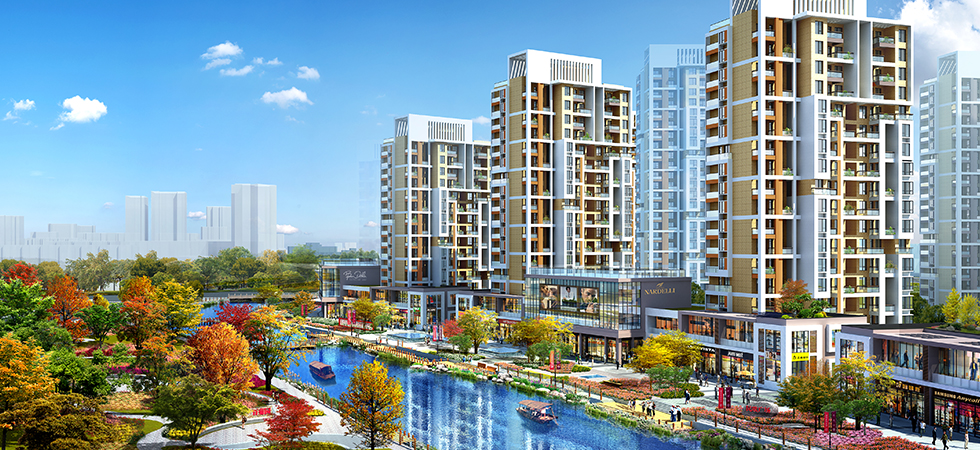
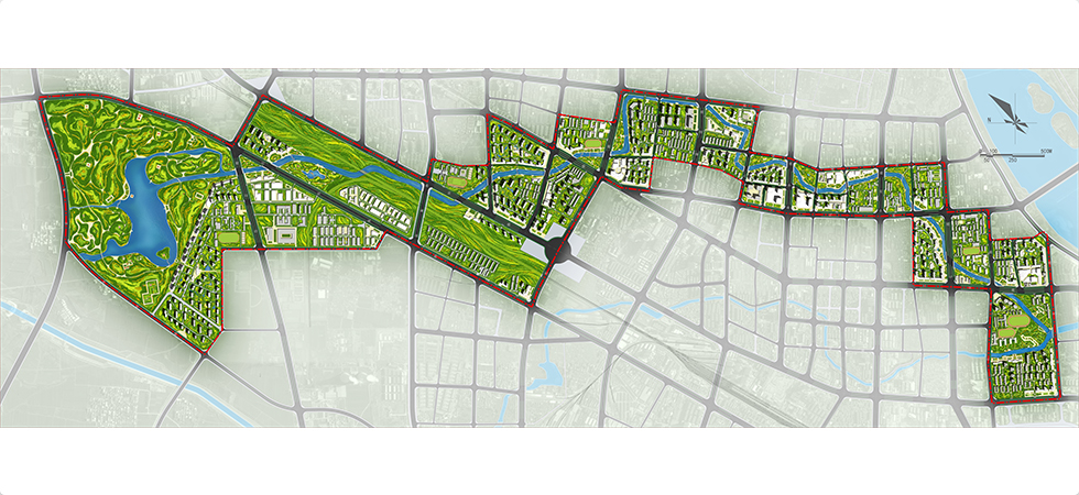
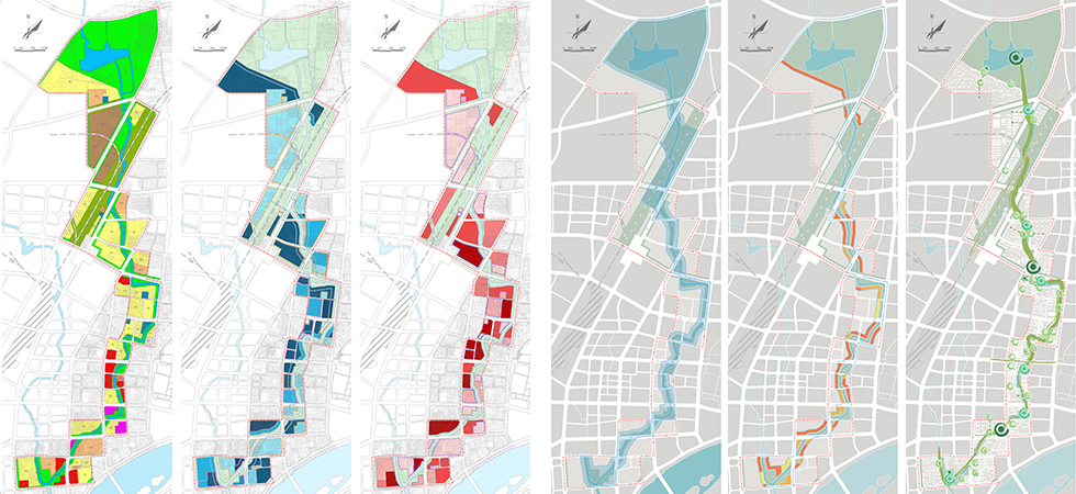
The Meixi River originates from the southern slope of the Zishan Mountain, flows into the downtown through Jinzhuang Reservoir and flows into the Baihe River at the location of Yellow Dragon Temple and has a total length of about 23.5 km. The planning area reaches JingWan Avenue in the north, Wolong Road in the south and the regions one block away from each side of the blue line of the riverway in the east and west respectively, has a length of about 8.8 km and covers a total land area of about 6.4 km2. The surrounding area of the river is mainly commercial land. Corresponding to the commercial environment with the kindheartedness of Commerce Sage Fanli and the brilliant culture of folk song and traditional drama and echoing the environment of Meixi with plum blossoms and chrysanthemum, the planning mainly highlights the commercial prosperity of Nanyang and intends to build the Meixi River into a river of kindheartedness. The planning area is divided into the south, middle and north regions by Zhnagheng Road and Xinhua Road. The north region is the ecological natural district mainly including the green land of reservoir and will build plum garden and chrysanthemum garden on the waterfront. The middle region is the dwelling district mainly including residential land and will build stage for traditional drama and square for folk songs on the waterfront. The south region is the vigorous region mainly including commercial land and will build the Kindheartedness Square on the waterfront.


 原创先锋
原创先锋